Mesovortex.com


Wednesday May 25, 2016

Chase Partners:
Randy Baker, Brian Fischer, Steven Peak

Departure Location:
Woodward, OK

Target Area:
Wichita, KS

Final Location:
Salina, KS

Distance:
408 miles

A great shot of the Tornado as we pull up to it.

The only way to describe this day was crazy.  After looking at a marginal day for severe weather the play appeared to be in south central Kansas and north central Oklahoma where an outflow boundary, dryline and further north a stationary front were in play. The best moisture, instability and lift were across south central Kansas so we head towards our target area in Wichita, Kansas in the late morning. While we are waiting we are upgraded to a slight risk for severe weather with tornado probabilities increased given the high instability and shear. We are sitting in a moisture pool across Wichita with dew points in the middle 70s so we are fairly confident we picked a good area to target.

Several hours have passed and storms pop up in the late afternoon just to our east and further north near Manhattan, Kansas. Given how juicy our airmass is we follow the storm east past Wichita and El Dorado. The storm tries its hardest to get going, however as we approach the storm it becomes obvious the base of the updraft is very small and the storm subsequently dies rather rapidly. Meanwhile, about 90 minutes to our north the storm near Manhattan is rapidly developing a hook echo and about to go tornadic. Although it is 630 pm, there are still several hours of sunlight left so we make the decision to head north towards that storm and hope for the best.

We take Highway 77 north to Highway 56 then track north on Highway 15 towards Abilene.  When we get to Abilene as notice we are behind the storm so we head east on county roads since the storm was going to cross the highway.  It becomes a race against time as we pass through Enterprise  then south of Chapman as the tornado was tracking through that town.  A few county roads later we catch up to the tornado about 4 miles southwest of Wreford and 13 miles east of Enterprise around 835 pm CDT.  The tornado itself was coming right at us so we had precious time to take pictures before getting out of its path.  I had time to snap some pictures but not enough to shoot any video as time was of the essence.  We caught the wedge tornado in its dying stages as the tornado was more of a stovepipe that quickly roped out in front of our eyes.  Had we been 5 minutes later we would have completely missed the tornado and busted big time!

We quickly get south of the storm and out of its way and head west back towards other cells that were developing.  We caught some lightning video and pictures of the prolific light show that the additional storms had to offer as the sun was quickly setting.  This storm went on to produce another tornado well to our east after the sun had set.  We then head to Salina, Kansas for the night where we enjoy some steak at IHOP.
  
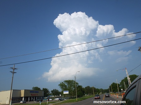
The storm near El Dorado, KS is trying to build
  
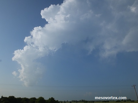
The storm vanishes before our eyes
  
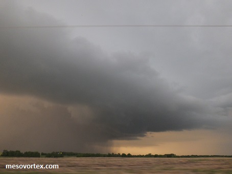
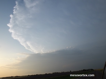
The storm east of Salina is absolutely huge
  
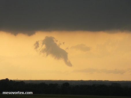
Some low scud beneath the base of storms to the west
  
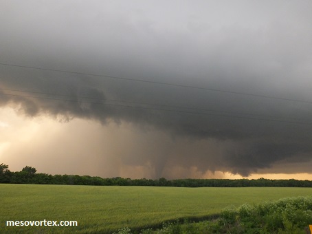
The tornado is so close we can taste it! Just on the other side of the rain
  
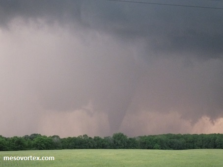
There it is as we get on the east side of the storm at about 835 pm
  
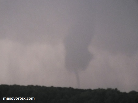
A closer look at the large tornado
  
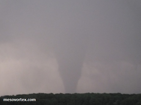
The tornado ropes out and dissipates
  
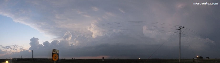
A panoramic of the storms to the west of the main storm. This one was producing prolific lightning!
  
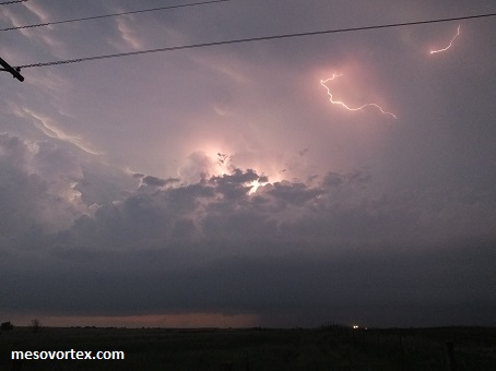
Lightning shot from this storm
  
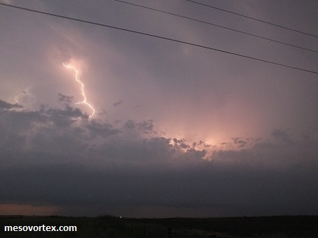
Another shot of lightning
  • Back to May 24, 2016
  • Ahead to May 26, 2016
  • Back to the Storms Page
  • Back to the 2016 Storm Chase Logs
  • Back to the Front Page