Mesovortex.com


Thursday May 26, 2016

Chase Partners:
Randy Baker, Brian Fischer, Steven Peak, Mark Rader, Nick Rader

Departure Location:
Salina, KS

Target Area:
Salina, KS

Final Location:
Woodward, OK

Distance:
428 miles

I seem to have a propensity for taking shots of Crepuscular Rays

The day starts out hopeful as the play seems to be a stationary front that was forecast to lift north across northern Kansas today. As of the morning Salina looked like a good place to be given the road options, so we decided to wait and see what developed throughout the morning at our hotel. Late in the morning the area was upgraded to a moderate risk with a good portion of Kansas in the outlook. However there were storms firing off to the west along the dryline late in the morning and early in the afternoon which was concerning since the best shear was not forecast to arrive until later in the afternoon and into the evening. Since Salina no longer looked like the area of interest we head south towards McPherson then west towards Lyons to investigate a storm tracking north northeast in the unstable airmass. This storm does not look very impressive so we abandon it for the line of storms out to the west near Dodge City which are tornado warned and show signs of weak rotation.

We travel south from Lyons on Highway 14 towards Highway 50 then west towards St.  John.  After arriving in St. John we head south on Highway 281 to investigate one of the tornado warned storms to our west. This storm does not look very impressive with no discernible rotation on radar so we continue south towards Pratt then into Medicine Lodge where we run into the storm chasing living legend Dave Hoadley.  We meet up with Mark and his son Nick to re-evaluate our options and decide what area to target next. Since the dryline is an option across western Oklahoma and the panhandle given the lack of earlier convection across this area our intention is to head west towards Coldwater then south towards Woodward. However as we are tracking west on  Highway 160 a storm develops west of Ashland with a pendant signature, some weak rotation and a tornado warning.  Figuring a bird in the hand was the best option we continue west past Ashland to intercept this storm. The storm itself looks outflow dominated but there is some rotation with it and it develops a wall cloud for a brief period of time so we continue with this storm, chasing it east back towards Coldwater then north towards Greensburg.

Between Coldwater and Greensburg the storm becomes very outflow dominant with the loss of any rotation, the pendant on the south side of the storm and the tornado warning.  With sunset quickly approaching and no other storms to chase before the sun sets we head back south towards Woodward.  With a massive storm just to our south we have to jog back west to head south on 183 instead of  directly south from Coldwater to avoid large hail given our adventure earlier in the week.  As we head back we witness incredible mammatus clouds and a rainbow west of Protection, Kansas.  Despite not witnessing any tornadoes today there were incredible pictures of storm structure as the sun set so the day was not a total loss.

  
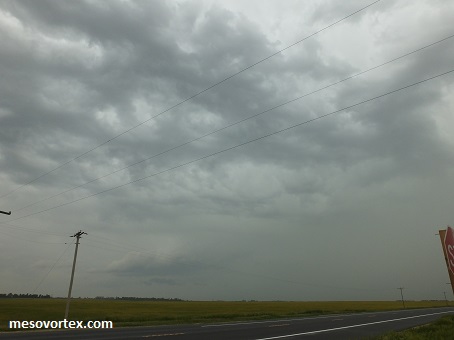
The storm near St. John, KS. Not much to see here
  
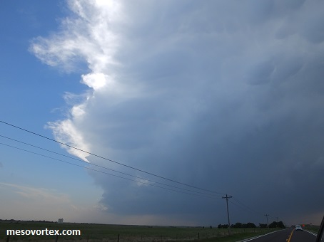
The storm west of Ashland is certainly looking interesting
  
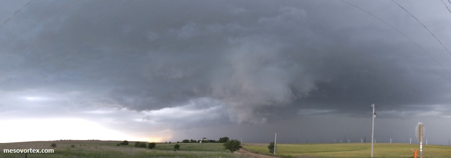
The storm is becoming better organized as we approach it
  
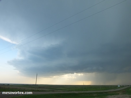
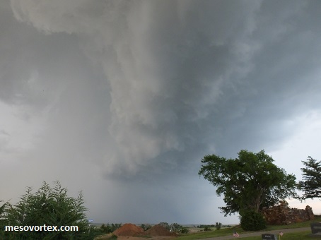
A lowering visible just to our north
  
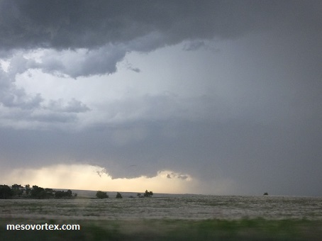
As we try to get ahead of the storm we see the wall cloud in the distance
  
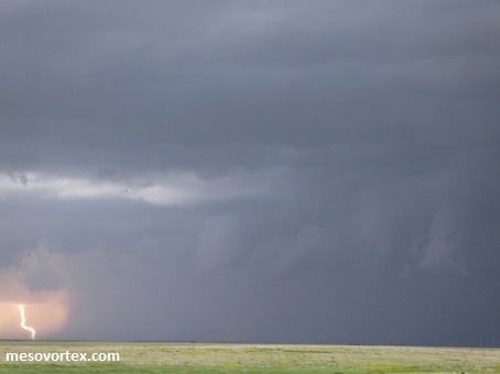
An incidental lightning shot as we head north to get ahead of the storm
  
The storm becomes outflow dominant and we abandon it
  
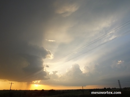
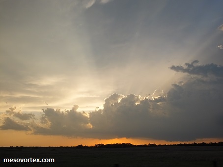
Crepuscular Rays never get old
  
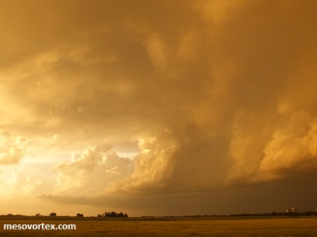
As the sun sets the clouds look like something not of this world
  
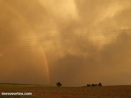
On the other side a double rainbow
  
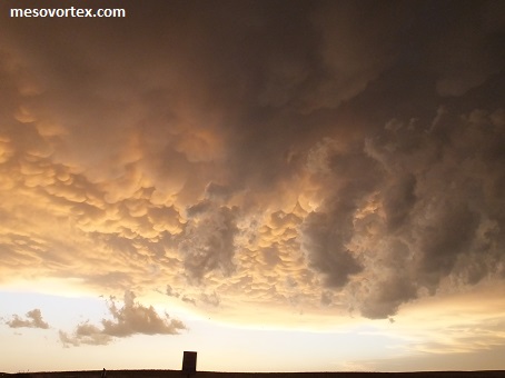
A spectacular display of mammatus clouds
  • Back to May 25, 2016
  • Ahead to May 27, 2016
  • Back to the Storms Page
  • Back to the 2016 Storm Chase Logs
  • Back to the Front Page