Mesovortex.com


Monday May 23, 2016

Chase Partners:
Randy Baker, Brian Fischer, Steven Peak, Mark Rader, Nick Rader

Departure Location:
Colby, KS

Target Area:
Buffalo, OK

Final Location:
Colby, KS

Distance:
618 miles

The money shot of the day. Tornado with the sun setting.

Wow what a day! Waking up to a northerly wind and the severe thunderstorm outlooks pushed south we knew we would have to book it south. However the question was just how far south. The best play of the day appeared to be in the southern Texas Panhandle area, which at first sight appeared to be a bit too far for us to make in time. Instead we go south to Garden City where things look like they could shape up decently in western Oklahoma given a ribbon of moisture tracking north near Woodward as well as an old outflow boundary slowly but surely sinking south across southern Kansas and the dryline out to the west in the Texas panhandle tracking east. We decide to target Buffalo, OK where we could make a play on the storms firing along they dryline and still be in position if storms initiated along the sinking outflow boundary.

Cumulus clouds perk up and die down all afternoon along the dryline and the old outflow boundary as we sit in Buffalo, OK. While we are there we run into our old friend and chasing partner Mark Rader and his son Nick. They tag along with us for the rest of the day as we chase. Two storms near Coldwater, Kansas caught our attention just after 5 pm. These storms formed along the outflow boundary with a Severe Thunderstorm Warning issued for the northern storm. We stay on these storms for almost 2 hours, however these storms have fairly skinny updrafts and are getting sheared off significantly. We notice a storm developing near Woodward, Oklahoma as the two storms in southern Kansas die off with the outflow boundary cutting off their updrafts so we book it south to chase the storm near Woodward.

We arrive to the Woodward storm just before 8 pm, with a lowering in the clouds and a Tornado Warning greeting us as we get to the south side of the storm. The storm itself has a nice mesocyclone and a persistent rotating updraft that keeps redeveloping to the northwest of Woodward, allowing us to maintain our position and watch the storm cycle as the low level rotation redevelops and the inflow into the storm surges several times. We watch the storm a good 45 minutes before the storm develops a hook echo with the first tornado touching down at 825 pm CDT.  The first tornado is on the ground for less than a minute, however the storm cycles several  more times with additional touchdowns at  827 pm, 829 pm, 831 pm, and 832 pm. The storm quickly becomes rain wrapped so we track a bit north to get a better view of the tornado before it ropes out around 840 pm.

After the storm loses its tornadic characteristics we attempt to head north towards Dodge City, however our efforts are quickly thwarted as we run into 3 inch hail and are rewarded with a cracked windshield. We then quickly turn around and find something to eat in Woodward before taking the long ride back to Colby to spend the night.

  
The storm near Coldwater, KS
  
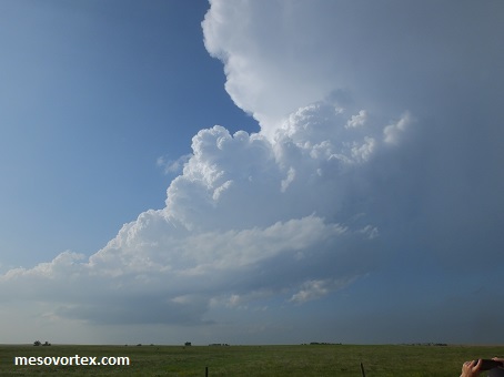
The Woodward storm as we approach from the north
  
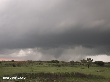
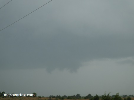
The lowering as we approach the updraft
  
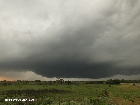
The storm is becoming better organized with a hook echo on radar
  
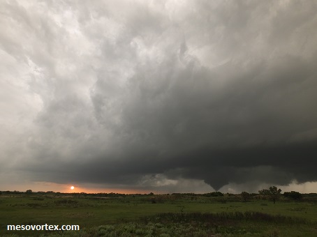
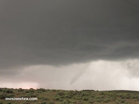
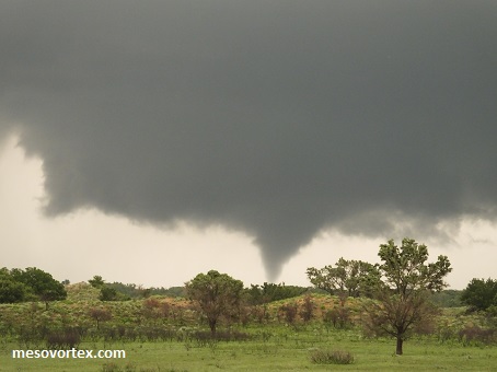
The first tornado of the chase!
  
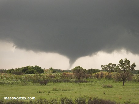
Another tornado cycle underneath the mesocyclone
  
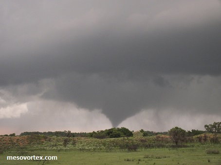
The fifth and final tornado touches down
  
The tornado becomes rain wrapped
  
The rain wrapped tornado dies out
  
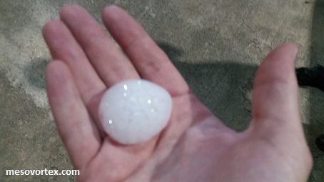
The hail storm that damaged our windshield, partially melted
  
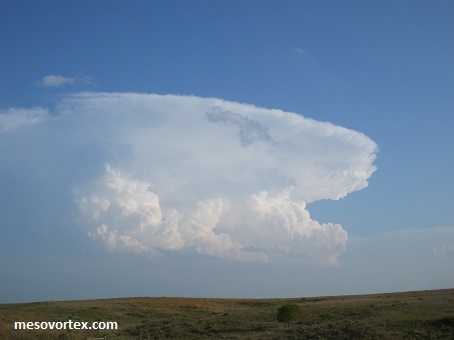
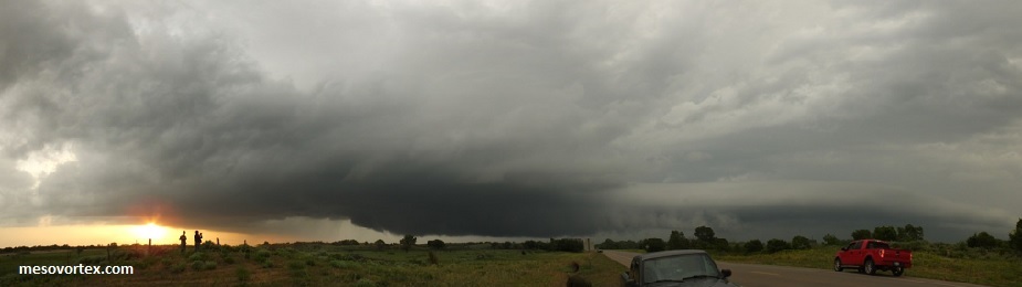
A panoramic of the Woodward storm before it produces a tornado. Mark and Nick are to the left

YouTube video of the tornado touchdowns
  • Back to May 22, 2016
  • Ahead to May 24, 2016
  • Back to the Storms Page
  • Back to the 2016 Storm Chase Logs
  • Back to the Front Page