Thursday May 22, 2008


Met up with the chase team of Randy Baker, Mark Rader and Dave Inmon in Kansas City around 10 am and decided to head west towards Hays, Kansas to wait for storm initiating along the dry line to move north and interact with the warm front.  When we arrive at Hays around 230 pm convection is firing to the southwest and heading rapidly north.  We decide to head west to Grainfield then south to Gove on 23.  We saw a nice cell coming at us from the north...but decided to follow a cell further south.  By the time the first cell had a confirmed tornado we were too far south to intercept, so we kept chasing the southern storm.  We waited just east of Gove where we met up with Kirk Swain, then followed the cell north along 23 as it developed a nice mesocyclone and wall cloud.  As we approached Interstate 70 we noticed a low contrast tornado just to our north.  Despite some heavy rain, we caught some pictures of the tornado by adjusting our camera settings to account for the low contrast around 538 pm.  

We did not have long to celebrate as another cell to the south was developing a mesocyclone and heading northeast.  To intercept this cell we headed east on Interstate 70 and stopped 5 miles east of Collyer where we watched the developing mesocyclone to our southwest.  We noticed some inflow dust being kicked up to our south with 35 to 40 mph winds.  As the storm got closer to the interstate, the inflow became stronger as a tornado developed within miles of our location.  The inflow into the tornado was strong enough to completely knock me off my feet as we were close enough to the tornado that it took a few frames to capture the entire width of the tornado as it passed across the interstate around 635 pm.

We then headed east on 70 then north on highway 283 to keep tracking the storm as it headed northeast.  However the storm became outflow dominent as it moved north of the warm front.  We headed back south towards Wa Keeney as another tornado was headed towards our location just before 9 pm.  It was too dark to get any good shots of the tornado so we headed east on 70 where we encountered very strong winds as the tornado passed within a mile or so of our location.  With darkness upon us we waited the storms out in Ogallah to try and get some lightning before calling it a night in Hays. Dave Inmon's account of the chase is here. Drove a total of 631 miles today.


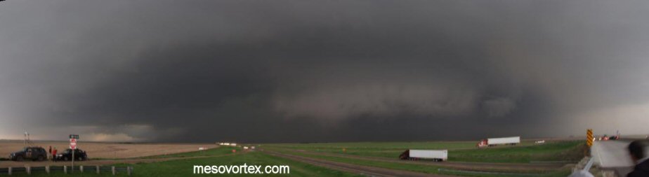
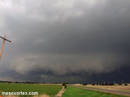
The mesocyclone development north of Gove
  
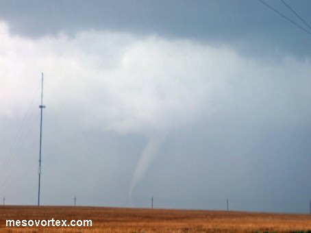
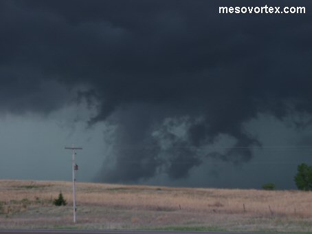
A tornado near Highway 23 and Interstate 70
  
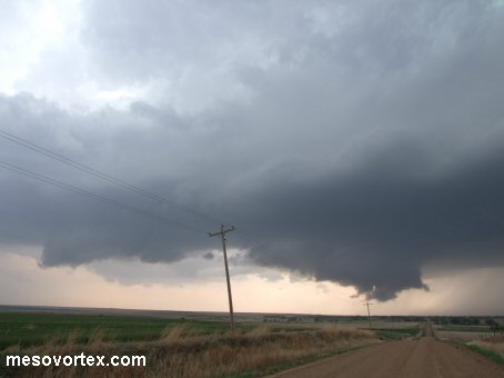
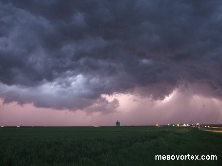
Another storm developing south of Interstate 70
  
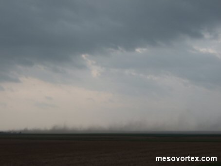
The inflow ingests dust into the updraft
  
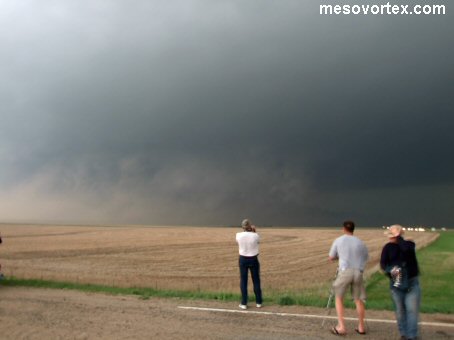
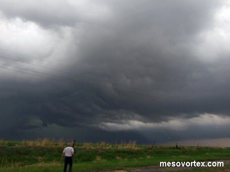
The tornado develops just after I get knocked to the ground
  
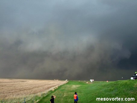
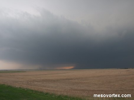
The tornado passes just a few miles to our east on Interstate 70
  
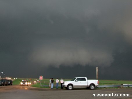
The storm as it moves north of the Interstate
  
A shelf cloud develops as the storm becomes outflow dominent
  
Scud clouds on the southern side of the storm
  
Some nice contrast in the clouds as we head west
  
The Wa Keeney storm after we are a safe distance away
  
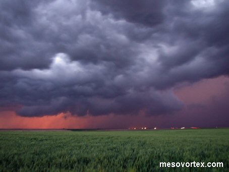
Lightning illuminates the storm to the north
  
A panoramic of the storm the produced a tornado near Collyer

YouTube video of the Grainfield tornado

YouTube video of us escaping the WaKeeney tornado

  • Ahead to May 23, 2008
  • Back to the Storms Page
  • Back to the Front Page