Monday May 17, 2004


     Woke up in Grand Island with a North wind as the front was to our South. The cold air aloft meant we clouded over pretty early. We met up with Matt's friends Adam, Chris, Russ and Becky south of Grand Island near I-80. Since we were north of the front we decided to head east then south towards Concordia to get into the warmer air. In Concordia we had a South wind but the clearing was still to the south so we headed towards Salina where we met up with Matt's friend Scott who gave us some nowcast help the previous day. The convoy of 3 cars then headed west towards Ellsworth when a data stop showed a cell blowing up near Russel, KS on the satellite. We decided to try and get in position to intercept so we headed north on 14 when a tornado warning was issued for the storm. We took 18 west towards Lucas then 232 south towards Wilson, KS where we saw the wall cloud in the distance with poor visual contrast. We then headed south to get out of the way of any Forward Flank Downdraft and be in position to see the developing storm better. When we got near Wilson Lake we saw a great view of the Mesocyclone and the Wall cloud. A little further south we witnessed the best structure the storm had to offer as a Beaver's tail inflow cloud...striations in the updraft...and the wall cloud were all highly visible. Although the storm had a strong Meso it failed to produce a tornado as the LFC heights may have been a bit too high for tornadogenesis.
     We got into Wilson where major Chaser Convergence occurred...in fact we saw a fellow Wisconsin chaser Don Lloyd and his wife. At this point the storm appeared to have weakened but we saw this before and fully expected the storm to cycle again. However when we felt the wind coming from the storm instead of into it we knew the RFD had undercut the storm and the show was over. Our original thoughts were to head towards Salina for the night but with all the severe storms to our East we decided to head west towards Hays, KS where again many chasers and the DOW were staying for the night. On our way we witnessed a very photogenic pileus cloud and illuminated Cb tower. Our preliminary thoughts are to target northeast Colorado and play the upslope flow. Drove 361 miles.
     Matt's pics and account of this day can be found here.
     Here are some pics of the storms over North Central Kansas:

  
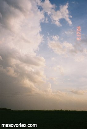
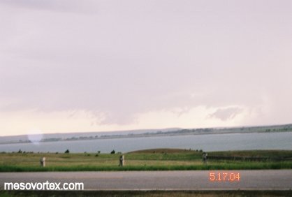
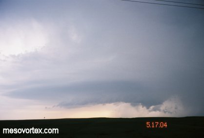
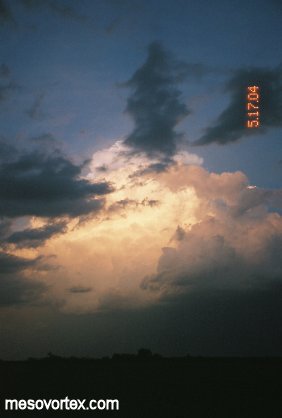
A developing storm that we decide to get in position for.
  
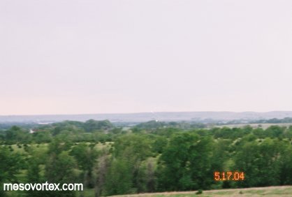
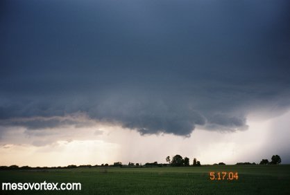
A developing wall cloud in the distance with poor contrast.
  
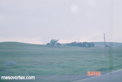
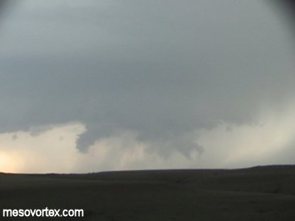
As we get closer the wall cloud becomes more apparent.
  
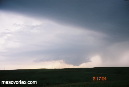
The storm becomes clearer.
  
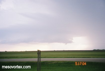
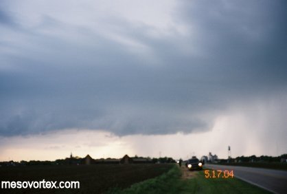
The lowering is now very apparent as the storm nears Wilson Lake.
  
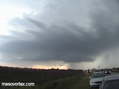
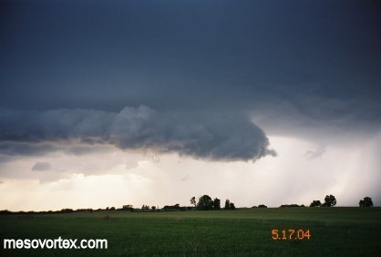
The best shot of the chase...a textbook supercell.
  
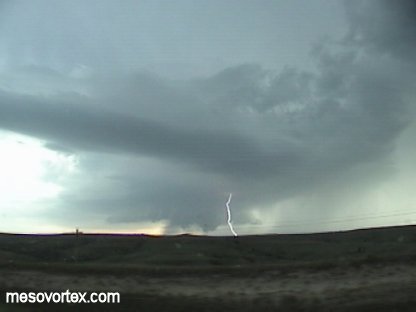
A wide angle shot of the entire storm from the video cam.
  
Notice the beaver's tail inflow at the top of the picture.
  
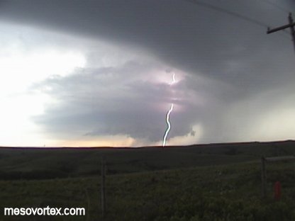
Striations in the cloud indicate a strong rotating updraft.
  
Although evidence of funnels is present the storm does not drop a tornado.
  
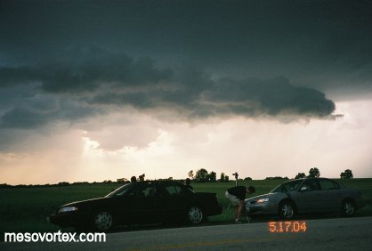
Still a well-defined wall cloud with other chasers in the distance.
  
A wide angle shot from the video cam again.
  
Last chance to do something.
  
Some pics of the chase team as the storm gusts out.
  
The RFD undercuts the updraft and the storm is done.
  
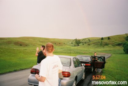
More of the chase team with a rainbow in the background.
  
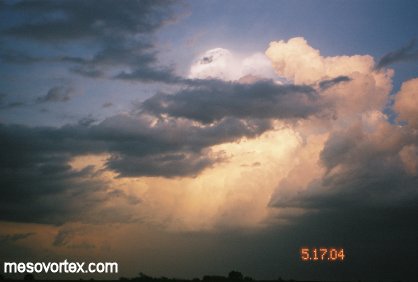
An storm tower illuminated by the sun on our way to Hays.
  
Notice the white pileus cloud at the very top of the Cb.

  • Back to May 16, 2004
  • Ahead to May 18-21, 2004
  • Back to the Storms Page
  • Back to the Front Page