Wednesday June 7, 2006


Convection was already going in southwest South Dakota...however northwest Nebraska was still sunny so we headed north on Interstate 25 then east on Highway 18 and then Highway 20 into Nebraska. By the time we got into Nebraska convection was already firing with a severe thunderstorm warning for Cherry County with a few good looking cells on Radar. We punch through one storm west of Valentine which was photogenic but did not do much as we passed through it.

Once in Valentine we headed south on Highway 83 to punch through the core of another storm since it appeared to be marginally severe with the strongest part of the storm to our east. Punching throught the storm we encountered 50 to 60 mph winds and hail up to 1 inch near Thedford. At this point there were several cells that appeared to be forming into one large cluster. Once south of Thedford we allowed the gust front to overtake us several times where the temperature dropped a good 20 degrees each time the front passed through. We then decided to take 92 east towards Arnold where the storm developed a mesocyclone and the storms merged again into one large Supercell. In Arnold a brief tornado developed to the northwest of town around 738 pm CDT and the sirens were quickly activated. Here is hi-res and lo-res video of the brief touchdown. Right click and save if video does not open properly.

We then headed south of Arnold on Highway 40 to try and stay south of the storm as it quickly approached us. We then zig zagged southeast until we made it Lexington with several photogenic scenes on the way. During the trip the lightning was overhead as some external antennaes caused static crackling inside the vehicle. Once in Lexington we were treated to a light show and decided to spend the night there. So far the best chase of the year!

  
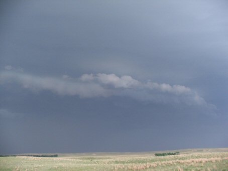
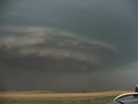
Shelf Cloud south of Thedford
  
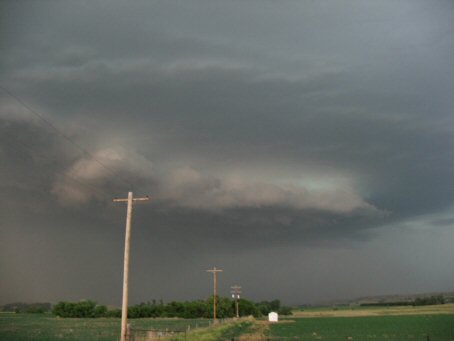
The developing mesocyclone on the southeast part of the storm
  
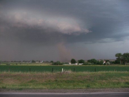
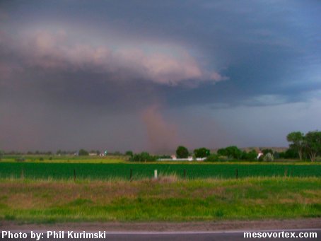
Tornado to the northwest of Arnold
  
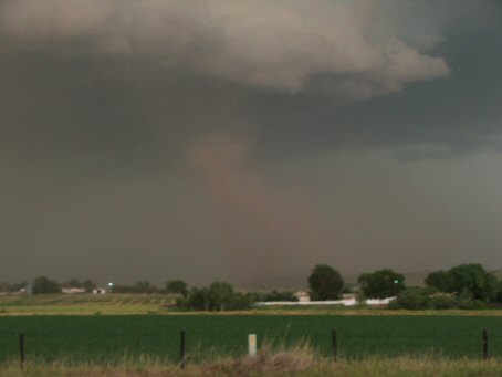
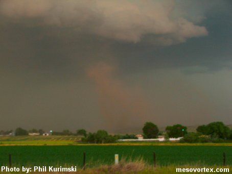
A close up of the tornado
  
Tornado photo enhanced
  
Same done to the close up
  
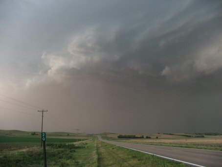
A very well defined gust front to our west
  
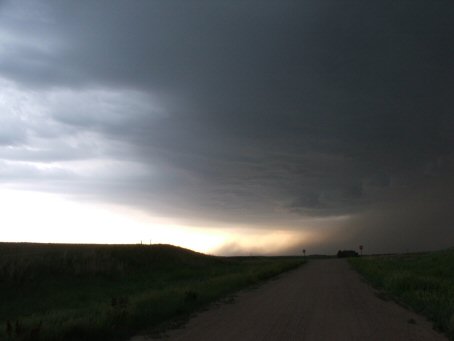
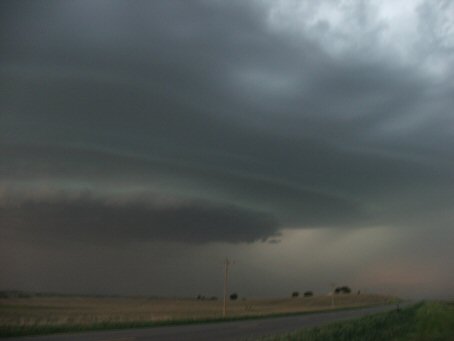
The gust front looking east as it hides the mesocyclone
  
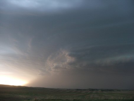
The mesocyclone appears again as we head east
  
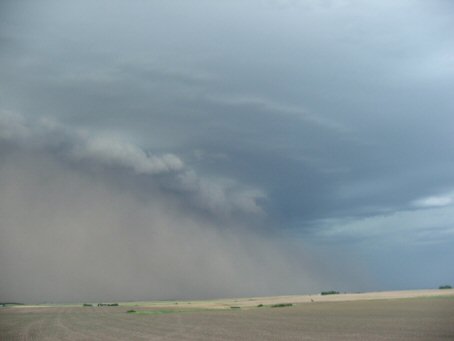
The dusty gust front with a shelf cloud
  
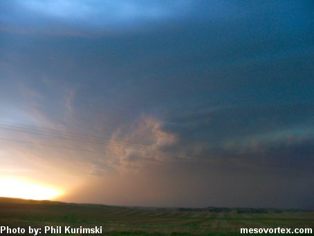
The mesocyclone becomes more outflow dominate
  
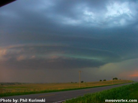
A very photogenic shelf cloud as we approach Lexington
  
An enhancement of the mesocyclone pic
  
The shelf cloud enhanced
  
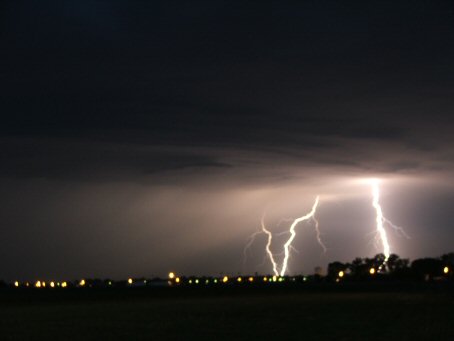
Lightning near Lexington
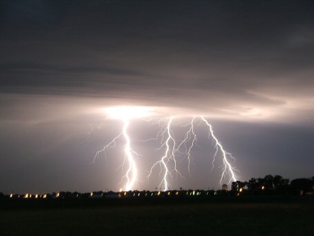
  
Multiple strikes

YouTube video of the tornado

YouTube video of the lightning

  • Back to June 6, 2006
  • Ahead to June 8, 2006
  • Back to the Storms Page
  • Back to the Front Page