May 18-23, 1998
Stationary front sitting over the Nebraska/Kansas border. Storms fire
up early in the
afternoon with upslope from the Rockies over Colorado and Wyoming then
make their way
eastward over western Nebraska and Kansas. This was a UW-Milwaukee
storm chase team of myself, Bennett Ozminkowski, Matt
Kosmider, and Brian Jalas. For more pics and the team account go here.
The following account was taken and
edited from the UWM Storm Chase web site. Pictures were taken by Brian
Jalas.
May 18
We departed about lunch time heading for southern
Minnesota. When we
arrived in the mid evening the atmosphere was strongly
capped. Only a cold front well off to our west would be
capable of producing
thunderstorms. We witnessed two weak elevated thunderstorms
that managed to tap the
surface moisture for only a brief moment, but faded quickly.
We
checked into a hotel in Rochester, MN for the night. A strong
line of storms
moved in from the west and began to drop Quarter size hail on our
hotel. We
had a great view of the hail under a covered outdoor walkway at the
hotel. Piles of
hail formed under water spouts and rivers of hail flowed in the parking
lot. A very unexpected finish to day 1.
May 19
We headed southwest towards the Nebraska Panhandle when we
were stopped by a
flat tire (Group 1 called this a "slow leak") that group 1 had started
by getting a nail into the tire. We managed to find someone
who could fix
the tire relatively quickly in Iowa and were on our way. We
lost about 2 hours due to the slowdown. We made it out to
Ogalala in the Nebraska panhandle shortly
before sunset as a squall line moved in from the west. We
experienced a
strong gust front as the line passed over. We also watched
lightning
outside our hotel later and had a nearby cloud to ground strike that
sent us quickly to our room.
May 20
We drove up to Alliance waiting for storms to intensify as
they moved towards
us. We encountered a storm to our north that produced a wall
cloud and a
ground based spinup but we were too far away to determine if it was a
tornado. Later we headed southeast to a cell with a tornado
warning.
We witnessed an anticyclonic funnel cloud and found ourselves stuck on
the
northwest side of the tornadic cell until sunset. We spent
the night in
Sidney.
May 21
At 11am a tornado warning was issued near Scottsbluff so we
headed up to the
northwest but the storms were weak by the time we got to
them. A
nice smaller supercell formed just to our south around lunch time so we
watched
it from a highway marker stop. A tornado watch was issued at
4pm for most
of western Nebraska. We headed south out of Gering and
encountered a storm
that produced a spectacular wall cloud, but no tornado. A
tornado was
reported near Sterling, Colorado so we headed southeast to try to get
into a
good position. We drove south out of Hayes Center (which was
a great move
as 10 minutes later Spotters reported softball size hail in the town)
since there was
no shelter from the hail in sight. We
were overtaken by rain and wind driven small hail but were lucky enough
not to encounter
large hail. After emerging from the rain we saw a rotating
wall cloud to
our southeast with a funnel cloud. A short time later a
column of dust
could be faintly seen rising up from the ground under the wall
cloud.
Quite an incredible day.
May 22
Moderate risk over eastern Nebraska busted on this
day. We
spent the evening driving east to Lincoln to spend the night.
May 23
We went to the east side of Kansas City. Storms
formed
northeast of a surface low and moved through northern
Missouri. We bumped in
to storm chaser Jeff Piotrowski, who quickly lost us as he speeded down
the highway.
We made it to the storm and set up behind the flanking line to witness
a
few wall clouds before darkness set in and we took to the long drive
back
home. All told it was a very successful chase for us.
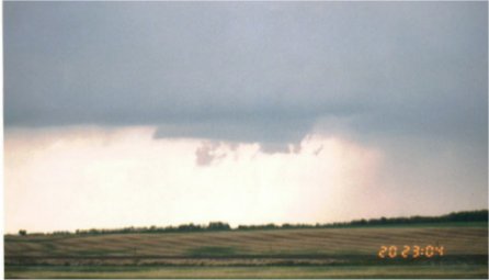
A rotating wall cloud on May 20th with debris cloud underneath
|
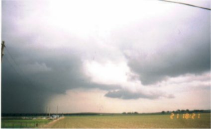
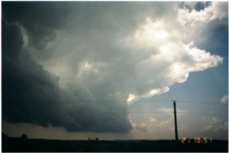
Very strong thunderstorm on May 21st with lowering of the cloud base
|
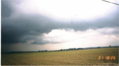
Appears to be a wall cloud on further inspection
|
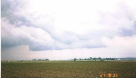
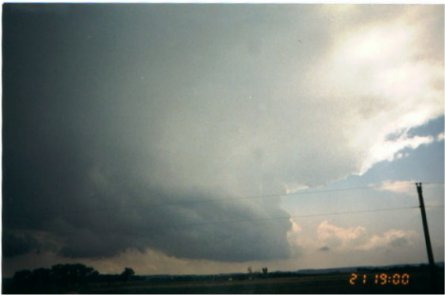
Indeed a wall cloud
|
The wall cloud refuses to drop a funnel cloud
|
The storm begins to weaken
|
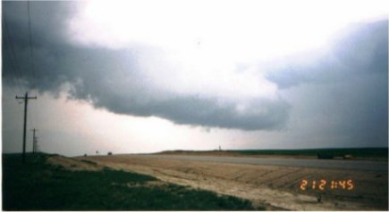
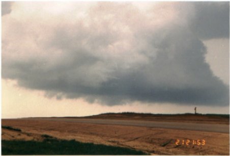
A storm over the Nebraska Panhandle that is starting to rotate
|
Sure enough the storm eventually shows very strong rotation
|
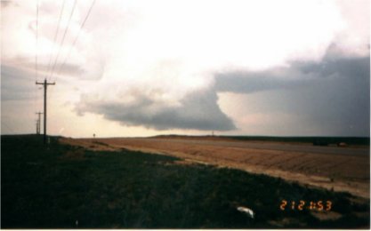
A close-up of the base with a possible wall cloud forming
|
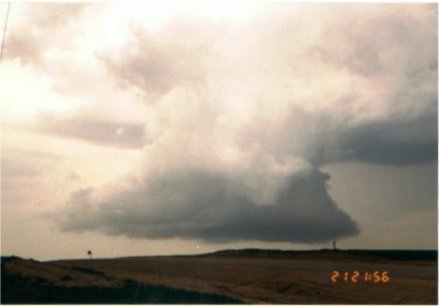
The storm exhibits stronger rotation...but no funnels or tornadoes
|
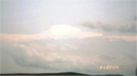
An overshooting top somewhere in Colorado
|
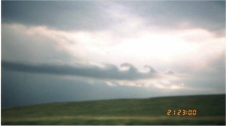
Kelvin-Helmholtz instability waves
|
Back
to the Storms Page
Back to the
Front Page