Tuesday June 3, 2003


     Drove to Kansas City with a slight risk in KS for Day 2. Upslope appears to be the main forcing mechanism as the storms will move eastward during the evening.

Wednesday June 4, 2003


     There was a slight risk out to the west. Instabilities and environment showed that the main trigger would be upslope on the lee of the Rockies then the storms would move eastward and form into an MCS during the nighttime hours. Target area was western Kansas so decided to head to Wichita and assess the situation there. When we go to Wichita there were storms moving through the OK panhandle S-SE into the TX panhandle. Got on the phone with Matt who was still in the stratus with little weather radio coverage and told him to move south and he would see the storms...well he saw the storms as he moved south of Boise City. At this point I was like if I cant get there I will help someone who can. Then decided to head southward into Oklahoma to see if I could get south of the stratus clouds and see the storms as they moves through OK. On the way I saw a scary sign that said Hitchhikers may be escaped inmates as the inmates mowed grass unsupervised...so needless to say I did not stop in that town. Anyway it was 8 pm with no end in sight to the stratus and I had only made it to Woodward, OK where I spent the night...which later turned out to be a mistake as I could not connect to the internet there and my phone said no service whenever I tried to connect. So with no internet I got a calling card and called Matt who said tomorrows target would be Northeastern NM.

Thursday June 5, 2003


     Leave for the OK panhandle bright and early and see some promising breaks in the clouds. However things that look close together on the map seem to take a very long time to travel to in OK. Finally got a good enough connection in Guymon to connect to the internet and saw a clear slot in eastern NM so decided to head towards Dalhart and try to get into the clear air. When arriving in Dalhart the radar showed some cells to the northwest between Dalhart and Texhoma moving towards highway 54. Talked to Matt in the clear slot who said nothing was really happening there and could not see any impressive towers building. With this we headed back to Texhoma as there were no warnings out with the storm but it appeared to be the best thing out there. On the way the SPC issued a watch box for the area so proceeded with caution. When running into the storm there was a lot of rain and wind south of stratford...but no real great structure to speak of. The underneath of the clouds were convectively lumpy and there was an overall lowering due to the moist air in the region. In stratford there was some minor flooding on the side of the road and some low lying parking lots but nothing else to speak of.
     However north of stratford things changed. At 2120Z we saw a bit of 1/2" hail by the side of the road. At 2125Z there was a camper blown over by the strong winds in the middle of the road. North of this accident there was so much hail that it covered most of the road and made driving difficult. From this evidence the core of the storm appears to have moved between Stratford and Texhoma shortly after 2100Z. Given the cloud cover and limited download capability decided it was time to call it a day and cheat northward for the next days potential in either CO or IA and headed for Salina KS. At Salina stayed at the Baymont hotel which had Broadband! With this nice connection I looked over the data and would target either CO or IA based on the morning information.
     Here are some pics of the more interesting things seen on this day:

  
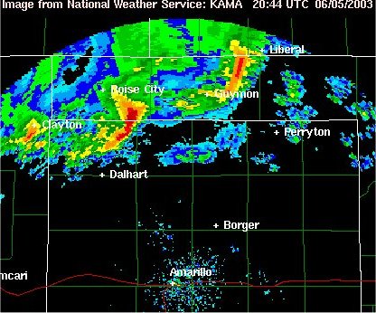
Here is a radar image of the storm we are about to go after
  
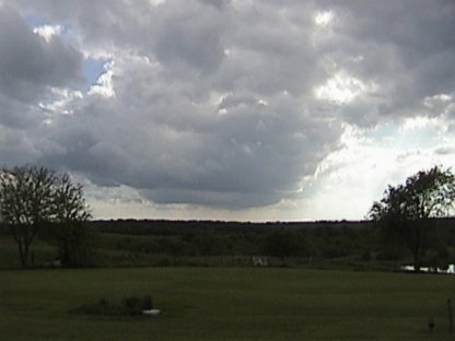
Finally a cloud that isn't flat stratus
  
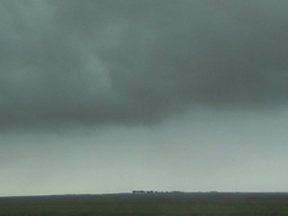
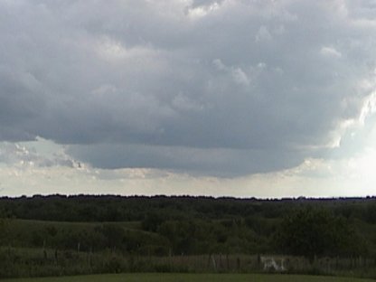
Very low clouds due to the moisture
  
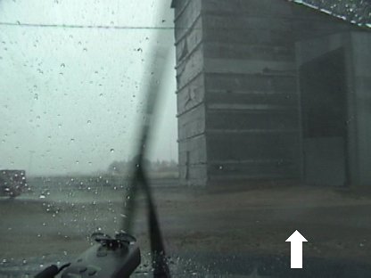
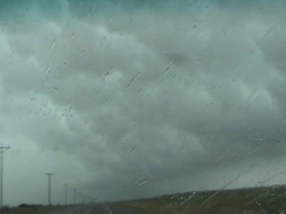
Some wind driven rain indicated by the arrow
  
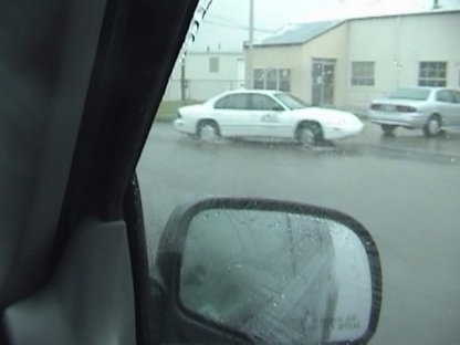
Minor flooding on the roads in Stratford
  
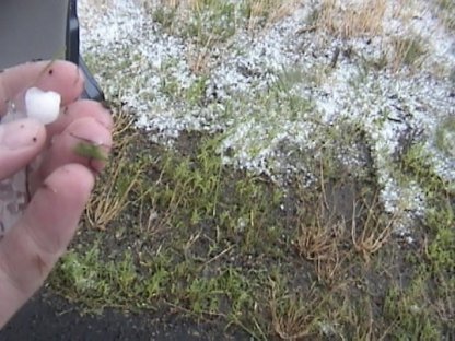
Here is some 1/2" hail just north of Stratford
  
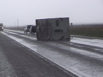
The camper blown over by the heart of the storm
  
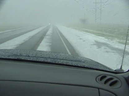
Hail covering the road and creating fog
  
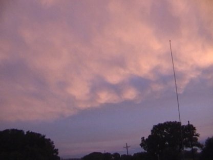
Clouds over Kansas on the way to Salina
  
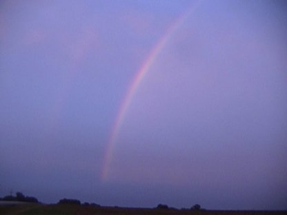
A double rainbow looking the opposite direction

Friday June 6, 2003


     Morning runs indicate that the best potential for organized severe will be IA. There is not a whole lot of instability with the complex moving into Colorado and the Bufkit data showed no real turning at lower levels...this stuff appears to be a wind maker with no real hail or tornado threat. The instability in IA is a bit better but nothing to write home about with CAPES below 1000 J/kg but the potential existed to see some structure as there were clear skies and a cool front moving through the region. The 1630Z Day 1 confirmed my suspicions as they put IA in slight risk as storms fired in the clear slot in Central IA. The storms are moving Eastward at 15 mph but starting to wonder if we will catch the storms at this point. However the stuff in WY appears to not look that great and IA is on the way home. At 2000Z I lose my internet connection due to the stupid ISP. But it does not appear to matter as the storms are heading well to the east at this time and weakening. The current clouds...although pretty...do not offer much potential as they are on the cool side of the front. Decide to head towards Davenport and call it a night. Later that night found out there was indeed some tornadoes and hail in Colorado. Oh well that is the way the week was going at this point.
     Here are some pics of the small developing cumulus clouds on the way to Iowa:

  
Some small developing cumulus near the IA/MO border
  
A close up shot

Saturday June 7, 2003


     Headed back to Green Bay. Talked to my chase partner Scott Cultice in Appleton who said there was some potential in IN on Sunday. Will get up at 1100Z and assess the situation.

Sunday June 8, 2003


     Decided due to the cloud cover and distance that the storms in IN were not going to be that great so stayed at home. However there were tornado warnings and sightings in Winnebago and Calumet counties so picked Scott up and headed south towards Fond Du Lac. At this point decide to take Highway 151 then 26 south towards Juneau to try and catch the storms. Unfortunately they were moving too fast and after driving over 100 miles to Juneau the warnings had expired...the storms had weakened...and again a bust.

  • Back to the Storms Page
  • Back to the Front Page